PointMan: GIS Data Collector 7.0.7.896
Free Version
Publisher Description


PointMan: GIS Data Collector - Locate utilities, complete electronic forms and perform survey workflows.
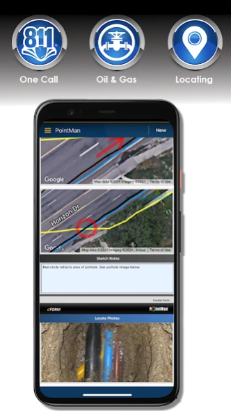
PointMan is a unique Precision Mapping Solution. Use PointMan Plus to help capture, record, and visualize the precise (x, y, z) location of critical surface & subsurface utility assets. PointMan's mobile app allows users to connect their mobile device with major GPS/GNSS, cable, and pipe locating equipment manufacturers to capture mission critical infrastructure data with unprecedented precision that includes; type, depth, accuracy, depth of cover, and precise geospatial location. PointMan can also create and bind forms, sketches, and photos to any point, line, or polygon and works in unison with mobile devices in order to display captured meta-data into a reliable mobile mapping software, all from the palm of your hand.
Upgrade to PointMan Pro to visualize, sync, and communicate meta-data captured by field personnel and make it immediately available for other office or field team members to view, in REAL-TIME. PointMan enhances captured-data security by working in unison between field equipment and mobile device, backing up critical asset data as it's being collected, and integrates it into an easy to use Precision Mapping Solution, viewable from any mobile device or desktop logged into PointMan Cloud Server, backed by AWS.
PointMan comes with a free 15 day trial of PointMan Plus features. After the trial period a one year subscription must be purchased to continue using the Plus features.
Plus features include:
Data Dictionary
Precision and Pedigree attributes
Differential correction
Export to Shapefile, CSV, and PDF
Import from Shapefile and KMZ
Locate PDF form
Geoid correction
Datum/EPSG collection
Multi-Feature Collect
***********************************************************
Uninstalling PointMan:
If you are a Plus user uninstalling will remove project data stored on your device. It is important to backup any project data before uninstalling PointMan.
Contact support@pointman.com
About PointMan: GIS Data Collector
PointMan: GIS Data Collector is a free app for Android published in the Geography list of apps, part of Education.
The company that develops PointMan: GIS Data Collector is Prostar, Geospatial Intelligence Software. The latest version released by its developer is 7.0.7.896.
To install PointMan: GIS Data Collector on your Android device, just click the green Continue To App button above to start the installation process. The app is listed on our website since 2024-04-19 and was downloaded 2 times. We have already checked if the download link is safe, however for your own protection we recommend that you scan the downloaded app with your antivirus. Your antivirus may detect the PointMan: GIS Data Collector as malware as malware if the download link to com.prostarcorp.pointman is broken.
How to install PointMan: GIS Data Collector on your Android device:
- Click on the Continue To App button on our website. This will redirect you to Google Play.
- Once the PointMan: GIS Data Collector is shown in the Google Play listing of your Android device, you can start its download and installation. Tap on the Install button located below the search bar and to the right of the app icon.
- A pop-up window with the permissions required by PointMan: GIS Data Collector will be shown. Click on Accept to continue the process.
- PointMan: GIS Data Collector will be downloaded onto your device, displaying a progress. Once the download completes, the installation will start and you'll get a notification after the installation is finished.
